We are happy to announce that following expert will participate on the GeoSpatial Summer School 2018, acting as leading lecturers and supervisors of the daily programme.
Helena Mitasova (NC State University, USA)
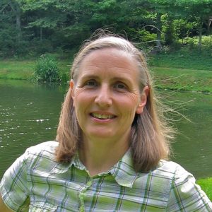
Supervision of the Day 3&4 (Spatial analyses)
Helena develops geospatial analytics to investigate coastal evolution, soil erosion control, natural hazards, and sustainable land management. Tangible geospatial modeling environments, dynamic simulations of landscape processes, and analyses of LiDAR time series data are some of the research frontiers she is advancing. Her interests also include Unmanned Aerial Systems (UAS) remote sensing and open source software development. Helena is a member of the OSGeo Foundation and the Open Source GRASS GIS Project Steering Committee, and is co-author of the first book on Open Source GRASS GIS.
Manfred Buchroithner (TU-Dresden, Germany)
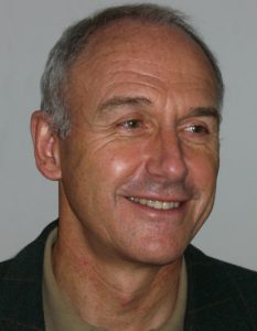
Supervision of the Day 1&2 (Geodata collection & management)
Manfred is an Austrian cartographer, geologist, mountain researcher and mountaineer. Manfred’s mayor research fields are true 3D visualization of geoinformation, high-mountain cartography, and remote sensing cartography; furthermore dynamic cartography with remote sensing, geographic information systems, environmental monitoring, digital media and multimedia in cartography, as well as epistomology of cartography. In 2013 he received ICA Diploma for Outstanding Services. He is currently the full professor emeritus of cartography at Technische Universität Dresden (Germany), Institute for Cartography.
Jaroslav Hofierka (UPJS Košice, Slovakia)
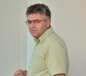
Supervision of the Day 2&3 (Geodata management & Spatial Analyses)
Jaroslav is full profesor in Geoinformatics at University of Prešov, Faculty of Humanities and Natural Sciences (Slovakia). His research area covers topics such as geographic information systems as a tool in landscape research, spatial interpolation and geomorphometry, digital terrain models, water erosion modeling, solar radiation modeling, cultural landscape and landscape changes, renewable energies, open source development and programing, municipal information systems, and 3-D city models and applications. He has got more than 25 years long experience with the development and use of open source software, namely GRASS GIS, and he is member of GRASS GIS Development Team.
Iván Sánchez Ortega (Nordic Semiconductor ASA, Norway)

Supervision of the Day 5 (Geovisualisation)
Iván describes himself as “ninja pirate robot unicorn rockstar, who used to do geomatics on the web, now doing javascript on electronics”. He is currently working in Trondheim (Norway) at Nordic Semiconductor ASA, and previously at MazeMap, Aptomar AS, Omnium Strategic Intelligence SL. He has a degree from Universidad Politécnica de Madrid and is the second most frequent contributor to Leaflet JavaScript library for interactive maps. He has done stuff with webpages, maps, and webpages with maps in them. Iván is joining the GeoSpatial Summer School 2018 to cover a Geovisualisation day.